What Is a Flood Overlay and Why Should Every Brisbane Buyer Care
Published 20 March 2026
Brisbane has one of the most complex flood risk profiles of any major Australian city. Built around a tidal river that drains one of the country's largest catchments, crossed by dozens of creek systems, and shaped by a topography that channels stormwater through established residential areas, the city has a documented history of significant flooding events stretching back over a century.
For property buyers, flood risk is not a theoretical concern. It is a practical reality that affects insurance premiums, development approvals, building floor level requirements, and ultimately the resale value and insurability of a home.
The starting point for understanding flood risk in Brisbane is the flood overlay system. This article explains what flood overlays are, the three distinct types that apply to Brisbane properties, and what each one means for your decision to buy.
What Is a Flood Overlay?
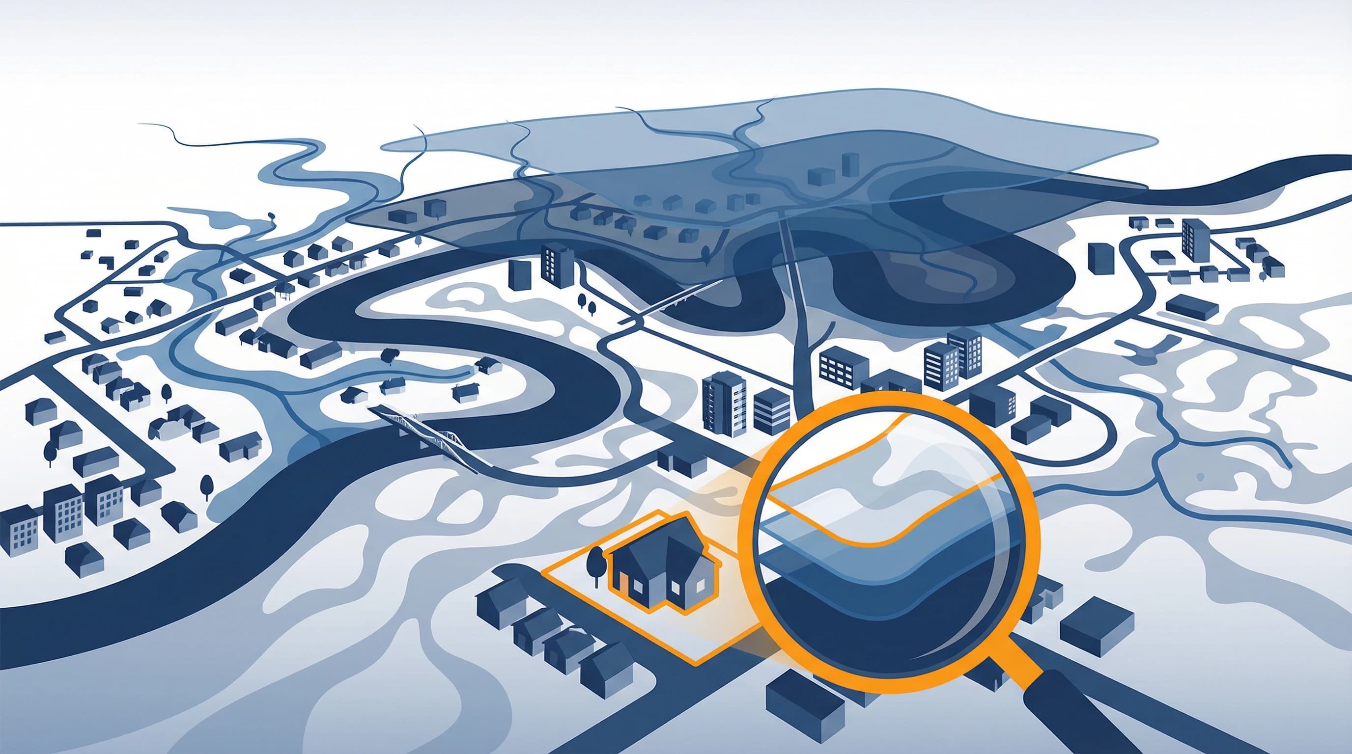
A flood overlay is a spatial designation applied to land within a planning scheme that identifies areas exposed to a defined flood risk. In Brisbane, flood overlays are incorporated into BCC CityPlan 2014, which is the statutory planning instrument governing land use and development across the Brisbane City Council area.
The overlays are based on flood studies commissioned and maintained by Brisbane City Council in conjunction with the Queensland State Government through QLD FloodCheck. They represent the best available technical modelling of how floodwaters would behave across the landscape under a range of rainfall and river flow scenarios.
The practical effect of a flood overlay is that any development application on an affected property must address the relevant flood planning requirements. This can mean minimum habitable floor levels, flood-resilient construction materials, restrictions on basement car parking, or requirements for emergency access and egress.
Importantly, a property can carry a flood overlay without ever having been physically inundated. The overlay reflects modelled risk based on topography and hydrology, not necessarily the lived experience of current residents.
The Three Types of Flood Risk in Brisbane
Brisbane's flood mapping distinguishes between three fundamentally different types of flooding, each with its own causes, behaviour, and planning implications.
1. Creek and Waterway Flooding
Creek and waterway flooding occurs when local creeks and streams overflow their banks during significant rainfall events. Brisbane has numerous creek systems, including Kedron Brook, Oxley Creek, Moggill Creek, Bulimba Creek, and many smaller tributaries, that run through established residential suburbs.
Creek flooding tends to be relatively fast-moving and can occur independently of Brisbane River flooding. A heavy localised rainfall event can cause a creek to overflow within hours, affecting properties that have never experienced riverine flooding.
Under BCC CityPlan, the creek and waterway flood overlay identifies multiple flood area categories, typically Flood Area 1, Flood Area 2, and Flood Area 5, representing different flood probability levels. These areas trigger specific floor level requirements and development assessment provisions.
Properties showing Creek Flood Risk in a due diligence check require further investigation into which flood area category applies, what the corresponding floor level requirements are, and what the insurance implications look like.
2. Brisbane River Flooding
Brisbane River flooding is the most well-known flood risk in the city, following the events of 1974 and 2011 in particular. The Brisbane River Flood Planning Area captures properties across a wide geographic area that can be inundated when the river rises to significant levels, whether through rainfall-driven flooding, dam releases from Wivenhoe Dam, or tidal influences.
The Wivenhoe Dam, constructed following the 1974 floods, provides substantial flood mitigation for Brisbane. However, the 2011 floods demonstrated that even with the dam in place, major flooding events remain possible, particularly when the catchment is already saturated from preceding rainfall.
Properties within the Brisbane River Flood Planning Area are classified at the Comprehensive Study Area level, meaning they have been assessed within the full flood modelling framework. This designation triggers specific building requirements and has direct implications for insurance.
Critically, a property can be listed as carrying Brisbane River flood risk at the "Comprehensive Study Area" level without being in an extreme risk category. The classification indicates that the property sits within the modelled flood extent and needs further investigation to determine actual flood levels and applicable requirements.
3. Overland Flow Flooding
Overland flow flooding is the least understood of the three flood types and arguably the most widespread. It occurs when the volume of stormwater runoff from rainfall exceeds the capacity of the underground drainage network. Rather than flowing through drains and pipes, water flows across the land surface, following natural and artificial drainage paths through the urban landscape.
Overland flow can affect properties that are nowhere near a river or creek. It is driven entirely by local topography and the capacity of the stormwater system. Low-lying backyards, properties at the base of slopes, and areas where natural drainage paths have been obstructed by development are all vulnerable.
Brisbane City Council maps overland flow risk across three categories: High, Medium, and Low. These categories influence development requirements and are increasingly being considered by insurers in their pricing models.
Even a Medium or Low overland flow risk designation warrants investigation. Repeated minor inundation events that individually cause limited damage can collectively result in significant mould, structural dampness, and building deterioration over time.
Why Flood Overlays Matter for Insurance
The relationship between flood overlays and insurance premiums has changed dramatically in Australia since the 2022 floods. Insurers now have access to substantially more granular flood risk data than was available even five years ago, and they are using that data to price policies more accurately, which in practice often means more expensively.
The Insurance Council of Australia reported that the 2022 Queensland and New South Wales floods generated over $6.3 billion in insurance claims. In response, many insurers tightened their underwriting criteria for flood-prone properties and significantly increased premiums for those they continued to cover.
For a Brisbane buyer, this means that the flood overlay status of a property is no longer simply a planning concern. It is directly linked to the cost and availability of building and contents insurance. Before committing to any purchase in a flood-affected area, obtaining insurance quotes from multiple providers is an essential pre-purchase step.
How to Check Flood Overlay Status
The primary tools for checking Brisbane's flood overlay data are:
Brisbane City Council's Flood Awareness Map, available through council's website, which provides a property-level view of creek, river, and overland flow risk. This is a publicly accessible resource but requires some familiarity with the mapping interface to interpret correctly.
QLD FloodCheck, the state government's flood mapping portal, which provides additional data on flood studies and floodplain mapping across Queensland.
A comprehensive property due diligence report, like those generated by PropDex, aggregates all three flood risk categories into a single clear document. Rather than navigating multiple government mapping systems, you receive a property-specific report showing whether creek flood risk is identified, whether river flood risk exists, and how the overland flow mapping applies. This is included alongside other key due diligence data points such as easements, zoning, and government land valuations.
Before you make an offer on any Brisbane property, generating a PropDex report at propdextest.com.au is one of the most practical steps you can take to understand the flood risk profile of the property. The report takes minutes to generate and covers data directly sourced from government flood mapping systems.
Questions Every Buyer Should Ask About Flood Risk
If a flood overlay is identified on a property you are considering, these are the questions that need answers before you proceed.
Has the property ever been physically inundated? Ask the seller directly and check council flood history resources. Seller disclosure obligations in Queensland do not always require explicit disclosure of flooding history, so a direct question is important.
What is the minimum habitable floor level required for any renovation or extension? This is set by the flood planning overlay and can significantly affect the cost and design of any planned works.
What are the insurance implications? Obtain quotes from at least three insurers before proceeding. Do this before making an offer, not after exchange.
What did the property flood to in 2011 and 2022? For properties with Brisbane River risk, the 2011 flood levels are a relevant benchmark. Some councils maintain records of peak flood levels by property that can inform your assessment.
The Bottom Line
Flood risk in Brisbane is real, it is geographically widespread, and it has genuine financial consequences for property owners. Understanding the three distinct types of flood overlay that can affect a Brisbane property, and what each one means in practical terms, is foundational knowledge for any buyer in this market.
The information is publicly available. The tools to access it exist. And the cost of checking before you buy is a fraction of the cost of discovering a problem after settlement.
This article is for informational purposes only and does not constitute legal, financial, or planning advice. Always consult qualified professionals and engage with Brisbane City Council directly for property-specific flood enquiries.